
Sabah’s coastline – the longest in Malaysia – possesses great potential for sustainable economic developments, covering ports, industries, ecotourism, hospitalities, fisheries, agriculture, aquaculture, energy, and real estate. The success of these developments lies at its early stage through understanding site conditions, risks, and engineering and operational feasibilities, and regulatory requirements. Investors and decision makers need to be well informed on these on top of financial and economic considerations. Physical and environmental risks as well as regulatory requirements are often overlooked in the absence of the right advisors and experts on the client’s team. As a result, projects discover such risks and “show stopper” late in the game, when redesigns are costly and approvals are in jeopardy. These situations are common and have put many investments and projects to failure.
For example, a mixed development is proposed on shoreline facing erosion and flooding risks which are not well understood by the client or project owner. As these are overlooked early, such risks will potentially put the entire development safety and integrity at risk during operation stage. The costs to rectify these upon construction are often high affecting the entire business operation and profitability. By identifying and evaluating such risks early, de-risking and strategic review can be carried out to enhance the investment and engineering resiliencies. The infrastructures can be better designed and reviewed to mitigate such risks from early on. This brings added values to design optimization and smoother regulatory approval down the road. If the review reveals risks that are too much to bear with, it would be wiser to relook into the investment viability or pick an alternative location.
Drawing from decadal experiences in Blue Economy, coastal engineering, and shoreline management, here are 5 Early-Stage screening steps that lead to successful Blue Economy developments. Contrary to common stereotypes, early-stage coastal screening does not necessarily require extensive resources and efforts should the right experts and advisors are being engaged.
- Start with A Good Fundamental Overview and Right Advisors
- Risk Mapping
- De-Risking
- Building with Nature & Increase Coastal Resiliency
- Align With Regulatory Pathway
1) Start with A Good Fundamental Overview and Right Advisors
A good overview and understanding on the project or development site is highly crucial prior to any investment decision, planning, and design commencement. Project owners and developers often focus on business, land, and socio-economic success criteria while often neglecting physical and environmental aspects. The latter often proves to be the deal breaker for most coastal and Blue Economy developments.
As good practice, the following physical and environmental aspects shall be looked into:
- Bathymetry and topography – What are the water depths? What are the ground or platform levels? Are they low and prone to flooding?
Geotechnical – What are the surface and subsurface soil conditions? Are there any hard substrate that could be challenging to manage/excavate? Is there a need to carry out a preliminary investigation and site reconnaissance? - General metocean climate such as water levels, currents, waves, winds, rainfall – How high are the tides and storm surges? Are the shorelines exposed to strong currents and waves posing safety risks? What are the seasonal wind and rainfall patterns?
- Shoreline stability – Are the shoreline eroding or stable over long term? How did the shorelines change seasonally? Are there any coastal flooding risks? What is the setback or buffer from high water line to the proposed development boundary and is it sufficient for mitigating nature erosion and flooding?
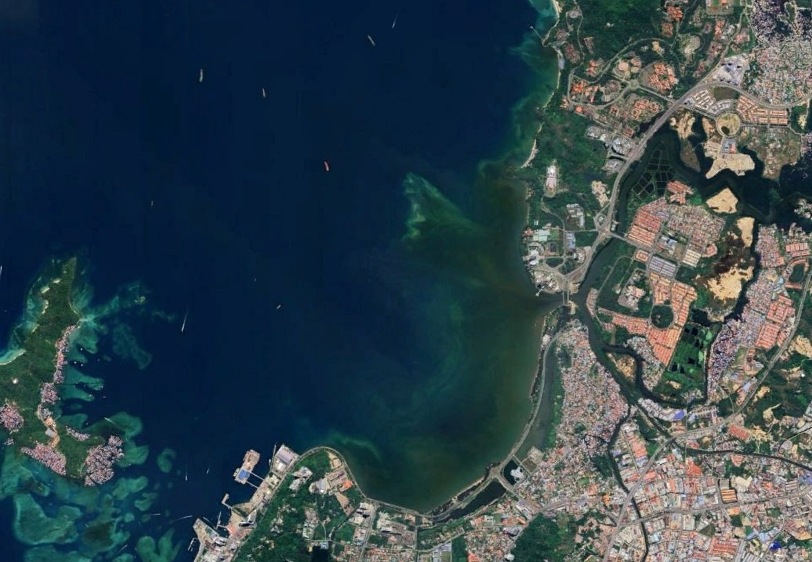
- Water quality – What are the water quality status? Is the site affected by pollutions? If yes, what kind of pollutants may be present? Is the water safe for recreational purpose? Are there any domestic sewerage or industrial effluents being discharged nearby? Are there any river or drainage outlets nearby?
- Sensitive Receptors – Are there any sensitive receptors such as forest reserve, mangroves, coral reefs, seagrasses, fishery grounds, and historical artefacts? Instead of viewing these as obstacles, they might be valuable assets to leverage on.
Information on the above can be sourced from past studies, secondary data and site inspection; whereas dedicated field survey fulfilling industry norms can be performed in later stage (e.g. feasibility, master planning, EIA, detailed design) should the project go ahead.
Data gap can be identified early on for planning ahead. If such data is not available at early stage, where feasible, assumptions and preliminary judgements can be sought from related experts or advisors whom have good experiences at the site.
2) Risk Mapping
Based on the collected data and information from Step 1, a risk mapping shall be carried out to clearly illustrate the spatial parameters of land use, cadastral, socio-economic, infrastructures, utilities, physical, and environmental. This can be easily performed using standard Geographic Information System (GIS) tools such as QGIS or ArcGIS. In the absence of such tools, the freely available Google Earth Pro can be considered.
The mapping shall ideally cover a radius searching of at least 3 km from the project boundary line. Higher radius (5 to 10 km) will be required for complex and large-scale projects, as well as presence of sensitive receptors near to the project site. Related experts can advise on this.
From the mapping, key risks and assets can be easily identified for better review and planning ahead. It aids clients in a transparent manner to derive desirable investment decision. At the same time, the outcomes will support experts such as insurer, architects, and planners to conclude their respective analyses. Among the general risks factors include:
- Potential impacts to nearby sensitive receptors e.g., coral reefs, mangroves, forest reserve, marine park. For this case, the risk mapping shall cover the entire sensitive habitats and not confined to the selected radius.
- Limited setback from high water line exposing development to erosion and flooding risks – as well as future sea level rise
- Highly mobile shoreline or beach – fluctuate seasonally and interannually which affect permanent structure safety
- Impacts from nearby existing beach development which could affect the shoreline stability and dynamics
- Presence of strong waves and currents such as rip which can affect navigation and recreational safety
- Presence of soft soil conditions which need to mediated or treated prior to construction
- Poor water quality conditions due to low recirculation and pollutants release
- Lack of utility and sewerage connections
3) De-Risking
Risks identified from Step 2 shall be clearly listed and evaluated accordingly, an effort that should be jointly carried out by experts and clients. Risk matrix approach can be considered as it is easy to understand and to communicate. Other approach selection shall be rooted in transparency and communication feasibility for general person (non-experts) to understand and act upon.
Each identified risks are to be categorized, ranked, and with mitigation actions or strategies proposed. The actions and strategies shall preferably be included in optimizing the overall development layout and other planning parameters. Inclusion of these will enhance the project design and operation moving forward. These also send a strong positive signal to regulator on the desire to minimize and mitigate any potential impacts to the environment, which would smoothen the overall approval processes.
4) Building with Nature & Increase Coastal Resiliency
Engineering design and work activities are often not the core focus during early stage of investment and project planning – especially for small to mid-scale sized projects. This is a shame as engineering insights will greatly enhance the overall project conceptual design and viabilities no matter the project sizes.
As early as possible, consideration on the type of engineering design schemes whether traditional, nature based, or hybrid shall be explored and included in the conceptual or architectural designs. They can be finalized and optimized during master planning and/or detailed design stages. A brief comparison of traditional engineering and nature based solutions is given below.
Traditional coastal engineering relies on building hard structures such as breakwaters, revetments, jetties, seawalls, and groynes to alter and stabilize coastlines for development. While this approach meets immediate needs, it often disrupts the overall coastline stability affecting neighboring facilities. For example, groynes and seawalls block the natural movement of sediments along the coast, which are essential for maintaining coastline formation. When sediment supply is disrupted, the downdrift part of the coastline erodes, continuing until it reaches a new equilibrium—by which time significant land, property, and even lives could be at risk.
Building with nature emphasizes observing and understanding how nature functions, then designing developments to fit in harmoniously. Instead of fighting natural forces, we work alongside them—and where possible, leverage on them. For example, in areas with the right environmental conditions, mangroves, coral reefs, and seagrasses can be “built” or maintained instead of using hard engineering structures, providing natural protection against waves, currents, and winds. Instead of breakwater, beach nourishment can be considered to wide the beaches to offer buffer as protection. Leveraging these resources brings added environmental and social benefits, such as marine biodiversity, fishery stock replenishment, wildlife restoration, and eco-tourism, thereby boosting the development’s image and reputation. Such concepts have been widely implemented across the globe.
5) Align With Regulatory Pathway
As explained above, understanding regulatory requirements and compliance is essential to any development, including Blue Economy. Client shall be well advised on these as early as possible. Such requirements and compliance must be considered and included as part of the project planning, evaluation, and operation. Considerations at early stage of a project greatly enhance its sustainability, save costs, improve regulatory approval likelihood, and boost reputation.
Key public stakeholders to be involved and consulted for Blue Economy and coastal/shoreline developments are (but not limited to):
- Sabah Maju Jaya (SMJ) Secretariat
- Environmental Protection Department Sabah (Jabatan Perlindungan Alam Sekitar Sabah)
- Department of Irrigation and Drainage (Jabatan Pengairan dan Saliran)
- Department of Land and Survey (Jabatan Tanah dan Ukur)
- Town and Regional Planning Department Sabah (Jabatan Perancang Bandar dan Wilayah Negeri Sabah)
- Marine Department (Jabatan Laut)
- Ports and Harbours Department Sabah (Jabatan Pelabuhan dan Dermaga Sabah)
- Economic Planning Unit (Unit Perancang Ekonomi)
- Sabah Forestry Department (Jabatan Perhutanan Negeri Sabah)
Among the key regulatory requirements for Blue Economy and coastal/shoreline developments are (but not limited to):
- Environment Protection Enactment 2002
- Environmental Quality Act 1974
- Environmental Quality (Sewerage) Regulations 2009
- Environmental Quality (Scheduled Wastes) Regulation 2005
- Town and Country Planning Ordinance (Sabah Cap. 141)
- Ports and Harbours Enactment 2002
- Land Ordinance (Sabah Cap. 68)
- Water Resource Enactment 1998
- Cultural Heritage (Conservation) Enactment 1997
- Local Municipal Rules Including Earthwork By-Laws
- Sabah Biodiversity Enactment 2000
- Fisheries Act 1985
- Wildlife Conservation Enactment 1987
Among the key guidelines to be referred to for Blue Economy and coastal/shoreline developments are (but not limited to):
- Handbook on Environmental Impact Assessment in Sabah (Second Edition) (Environment Protection Department, November 2005)
- EIA Guidelines for Land Reclamation Activities (Environment Protection Department, 2012)
- EIA Guidelines for River Sand and Stone Mining Activities (Environment Protection Department, 2012)
- EIA Guidelines for Earthwork Activities (Environment Protection Department, 2012)
- Environmental Impact Assessment (EIA) Guidance Document for Sand Mining/ Dredging Activities (Department of Environment)
- Environmental Impact Assessment (EIA) Guideline for Coastal Resort Development (Department of Environment)
- Guidelines on the Prevention and Control of Soil Erosion and Siltation in Malaysia (Department of Environment, 1996)
- Sabah Shoreline Management Plan (Environment Protection Department, 2005)
- Guidelines for Public Safety and Health at Construction Sites (Department of Occupational Safety and Health, 2007)
- Urban Stormwater Management Manual for Malaysia (MSMA 2nd Edition) (Department of Irrigation and Drainage, 2011)
- National Landscape Guidelines (Department of Town and Country Planning, 1995)
- Guidelines on Erosion Control for Development Projects in the Coastal Zone (Department of Irrigation and Drainage, 1997)
- Guidelines for Erosion and Sediment Control in Malaysia (Department of Irrigation and Drainage, 2nd Edition 2011)
- Sabah Mangrove Action Plan 2024-20233 (Sabah Forestry Department, 2025)
At CoastAdv, we assist stakeholders in screening and de-risking Blue Economy investments and projects. If you’re exploring a site—or if a concept already exists and you want a second look— a quick screening is valuable. It can save time down the road, protect your budget, and set your project up to deliver sustainable outcomes.