
Coastal flooding in Sabah
When flood news breaks in Sabah, most of us picture rising rivers and drains, landslides, water rushing down from the hills, and flooded roads. These are the flood patterns we know well. But there is another pathway that often gets less attention until it happens right at our doorstep: coastal flooding—a risk many of us are less prepared for (and less familiar with) compared to inland and river flooding.
Coastal flooding happens when seawater levels become high enough to encroach onto the shoreline and low-lying land, causing inundation that can extend inland—especially in flat areas near the coast and around river mouths. It can happen even without extreme rainfall. And when heavy rain does occur, the two can combine and amplify the flooding impact.
Understanding the causes
Most coastal towns drain stormwater into the sea via rivers, streams, and engineered drains. During low tide, these systems can discharge more easily by gravity. During high tide, the sea level rises and the “outlet” gets partially blocked. When that happens, drainage slows down, water backs up, and ponding becomes more likely. This is why some neighbourhoods flood faster (or stay flooded longer) during high tide than during low tide—especially when rainfall is persistent across multiple tide cycles.
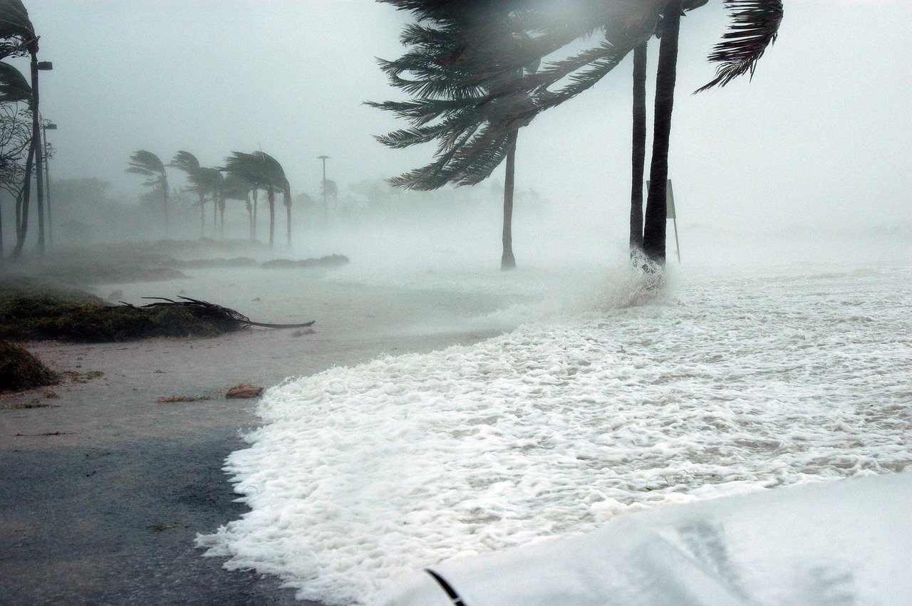
Coastal flooding is commonly driven by a mix of intense rainfall, high tides, storm surges, and wave overtopping. Understanding the difference helps the public recognise what is happening—and why.
Several times a year, tides run higher than normal due to the alignment of the sun and moon. Low-lying coastal roads, waterfront areas, and river mouths may see seawater overtopping or pushing into drains during these peak periods. For Kota Kinabalu, predicted tides show that the most extreme high-tide windows in 2026 cluster around mid-June and late-December, with other notable peak periods around late-November, early-January, mid-July, and mid-May. These periods can be anticipated in advance using tide prediction methods such as harmonic analysis.
During stormy weather, strong winds blowing persistently over the sea can temporarily “pile up” water toward the coast. This meteorological effect raises coastal water levels for hours (sometimes longer), especially when it coincides with high tide. Even a modest storm surge, when added on top of an already-high tide, can be enough to tip a location into flooding.
Even if the average sea level is not exceptionally high, energetic waves can run up and over beaches, seawalls, revetments, and waterfront edges—splashing water onto houses, roads, and walkways. It can also be dangerous for pedestrians and vehicles near the shoreline.
Kota Kinabalu City highly exposed
Kota Kinabalu has seen real examples along the Tanjung Lipat and Jalan Tun Fuad Stephens coastal road stretch as reported in late December 2022, where high tides and severe waves contributed to hazardous coastal road flooding and traffic incidents.
Coastal flooding is rarely caused by a single factor. The highest risk tends to occur when peak tide windows coincide with heavy rainfall, compounded by storm surges, limited drainage discharge, and degraded coastal protection structures (for example, damaged seawalls/revetments or eroded beach buffers).
Big Elephant in the room
And then there is the bigger “elephant in the room”: future sea level rise due to climate change. Globally, sea level is rising as the climate warms. Based on recent national sea level rise projection study, sea level around Kota Kinabalu may rise between 20 to 25 cm in the coming decades depending on the emissions pathway. To some, this may sound small. But along low-lying, flat coastal land, a small rise can translate into a large increase in flooded area and frequency because it raises the baseline water level. It also reduces freeboard (the vertical buffer) along coastal roads, drains, and waterfront edges.
Higher water levels also allow waves to reach shore with more energy. Over time, this can worsen wave overtopping and coastal erosion, and erosion in turn can expand flooding extent inland jeopardising more settlements and assets.
As sea level rises, today’s coastal flooding and extreme water level events would become more frequent, as tides and surges start from a higher water level baseline. For Sabah, this means that coastal areas that are “slightly low” today may face increasing flood risks in the coming years. It is crucial for us to evaluate and identify present and emerging flood prone areas for better planning and mitigation efforts. Priorities shall be given to effective land use screening and planning, development control or prioritisation, and nature based solutions instead of traditional hard engineering solutions which may not be sustainable in long-term.
A mindset shift in management, monitoring, and mitigation
Coastal flooding is a shared long-term challenge which requires us to rethink our management, monitoring, and mitigation approaches. While government plays a central role, public and private sectors, and community stakeholders must also play their parts through responsible development choices, proper maintenance, exploring innovative engineering, promoting nature based solutions, and above all – collective accountability. If we want to leave a safer environment for our future generations, it is time we talk about coastal flooding and take proactive actions earlier, not after the next big event.